Overview
Overview
Orion Enclave
ORION REALTORSManchapanahalli
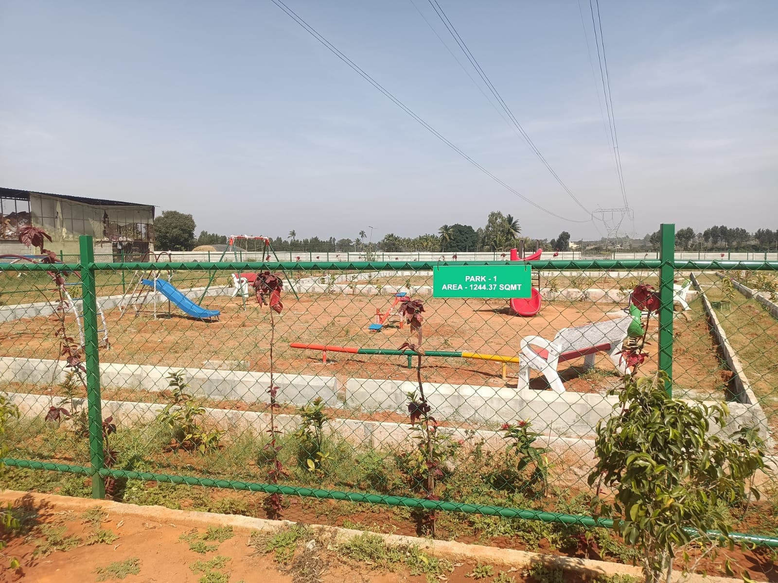
Site photos filed with K-RERA, Q3 2025-26
Recent price, super built-upNot verified yetSoldNot verified yetCompletion100%As of Q3 2025-26Possession promised30 Dec 2025Agreement for sale, p. 10Gross yieldNot verified yetNorth Bengaluru, past yearNot verified yetFindings1 to review · 2 clear · 3 locked
Sections
| Property title & search report | ||||
|---|---|---|---|---|
| Title & ownership | – | – | – | Locked |
| Approvals | – | – | 1 | Clear |
| Disputes & cases | – | – | – | Locked |
| Contract & costs | – | – | – | Locked |
| Technical report | ||||
Price paid per sq ft, super built-up
Not verified yet
Other projects in East Bengaluru
| 1 Lakhmulti Storey Housing Chikanahalli KamnahaliLapsed · completion date passed | Rajiv Gandhi Housing Corporation Limited | Apartment | 323 sqft carpet (as filed) | Mar 2024 |
| Aashrayaa Eco CityApplied for completion 06/08/2020 | AASHRAYAA PROJECTS | Plot | – | Sep 2019 |
| Adithya Homes Grand Phase 2Completed (regulator flag) | M/s.ADITHYA HOMES | Plot | ~1,520 sqft (estimate: filed carpet plus 25%) | Completed |
| Adithya Homes Grand Phase 3Completed (regulator flag) | M/S.ADITHYA HOMES | Plot | ~1,400–1,990 sqft (estimate: filed carpet plus 25%) | Completed |
| Adithya Homes Paradise Phase 2Applied for completion 09/01/2024 | ADITHYAHOMES | Plot | – | May 2024 |
| Adithya Homes Paradise Phase-3 |
Title & ownership
Who owns it, and is the title clean?
Locked
Title opinionNot verified yet
Records searched to
Charges on the landNot verified yet
Landowner share of salesNot verified yet
Land and deed chain
How the land reached this project
Approvals
Is it approved for its use?
Clear1 clear
Building plan (BMRDA)Sanctioned 18 Dec 2023No. HOPRA/LAO/24/2023-24
RERA extensionsNone on the filingFiling read 20 Oct 2026
RERA complaints0ClearClear
Land conversionConverted 27 Sep 2023Deputy Commissioner's Office Bangalore Rural District
Permits
Validity
Not verified yet
Approval letters
Disputes & cases
Are there court cases or buyer complaints on this project?
Locked
- Cases on the landNot checked
- Cases on the builderNo cases
- RERA complaintsNo cases
- Builder's other projectsNo cases
Unlock this full report
₹99 for this report opens Contract & costs, Title & ownership and Disputes & cases for this project, yours to read for good.
Contract & costs
What does a buyer commit to?
Locked
Forfeiture, agreement
Forfeiture, allotment letterNot verified yet
Transfer feeNot verified yet
Maintenance includedNot verified yet
Cancellation
Forfeiture
Not verified yet
Agreement and allotment letter
Valuation
What is it worth?
We haven't verified this for this project yet.
Sign in first, then it is one click.
Recent price, super built-upNot verified yet
Recent price, carpetNot verified yet
Phase 1 → Phase 2Not verified yet
Gross yield, per sq ftNot verified yet
This project
Price
Price per sq ft, super built-up
Not verified yet
Form 4 certified totals
Location & risks
What is the location like?
Height above nearest drainNot verified yet
Groundwater, taluk average22.6 m below groundHosakote taluk, July 2023
Water supply, as filedLocal authority (Tavakere Gram Panchayat)Declared by the promoter
Metro, operationalabout 23 kmWhitefield
The site
Zoning & hazards
Construction & progress
How is it being built, and when will it be ready?
Review1 to review · 1 clear
Completion100%As of Q3 2025-26, promoter's return
Possession, agreement30 Dec 2025Agreement for sale, p. 10
StructureNot verified yet
Structural safety certificateNot verified yet
Progress
Completion, architect
Not verified yet
Developer
Can the developer deliver?
Receivable, sold flatsNot verified yet
Cost leftNot verified yet
SoldNot verified yet
Sold in the latest quarterNot verified yet
Funding
Estimated cost
Loan & collateral
Can it be financed?
Value, 3BHK ANot verified yet
Max loan, 3BHK ANot verified yet
Borrower marginNot verified yet
Developer's project loanNo borrowing declaredAs declared in the K-RERA filing
Value & LTV
3BHK A
Not verified yet
Calculation
Not verified yet
Conditions
Collateral checks
Data room
Documents filed for this project
Documents filed138On K-RERA
Available138100% of filed
K-RERA only0
Approvals with a validity dateNone read
Approvals & NOCs
- Available
- Available
- 1 pageAvailable
- 1 pageAvailable
- 1 pageAvailable
- Available
- Available
- Available
- Available
- 1 pageAvailable
- Available
- Available
- Available
- Available
- Available
- Available
- Available
- Available
- 1 pageAvailable
- 1 pageAvailable
- 1 pageAvailable
- 1 pageAvailable
- 1 pageAvailable
Source: K-RERA project page and the documents filed there, as read by us. 29 documents filed with K-RERA, identity papers and photographs, are left out of this list.


